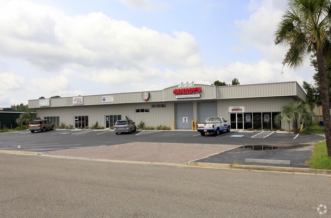
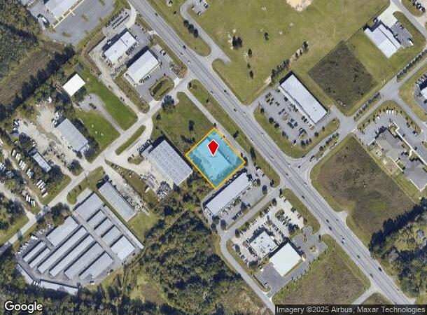
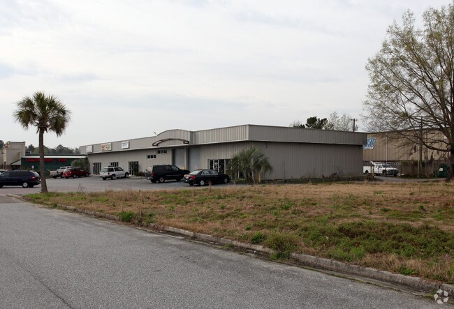
Property Record
1209 Us Highway 80 E, Pooler, GA 31322
NEARBY LISTINGS FOR SALE OR LEASE
Property Detail
1209 Us Highway 80 E
Savannah, GA
Ark Sub
5002201002C
LOT 12B POOLER INDUSTRIAL PARK SUB PH 2
Storebuilding
Chatham
A
Georgia
13051C0126H
12
2024
0.95 AC
2025
Bloomingdale/Pooler
010810
Savannah
9,600 SF
DEMOGRAPHICS near 1209 Us Highway 80 E
1 Mile
3 Mile
5 Mile
2024 Total Population
218
17,123
61,980
2029 Population
223
17,719
64,936
Pop Growth 2024-2029
+ 2.29%
+ 3.48%
+ 4.77%
Average Age
41
40
38
2024 Total Households
81
6,667
24,058
HH Growth 2024-2029
+ 2.47%
+ 3.64%
+ 4.93%
Median Household Inc
$58,888
$77,810
$73,743
Avg Household Size
2.60
2.50
2.40
2024 Avg HH Vehicles
2.00
2.00
2.00
Median Home Value
$143,055
$219,845
$232,895
Median Year Built
1986
2000
2003
Nearby Places
Map Layers
Map Styles
 Street
 Aerial
- Restaurants
- Banks
- Shops
- Fitness
- Groceries
PUBLIC TRANSPORTATION
AIRPORT
Savannah/Hilton Head International
DRIVE
WALK
Distance
Savannah/Hilton Head International
12 min
4.9 mi
Hilton Head
DRIVE
WALK
Distance
Hilton Head
57 min
44.2 mi
SALE & LEASE HISTORY
LISTING DATE
SALE/LEASE

Nov 01, 2024
For Lease
Nearby Properties
Address
Land Use
TOTAL SIZE
Lot Size
Zoning
Address
Land Use
TOTAL SIZE
Lot Size
Zoning
426,547 SF
15.29 AC
Address
Land Use
TOTAL SIZE
Lot Size
Zoning
432,965 SF
10.09 AC
Address
Land Use
TOTAL SIZE
Lot Size
Zoning
17,400 SF
19.34 AC
Address
Land Use
TOTAL SIZE
Lot Size
Zoning
42,338 SF
65.96 AC
PUD
Address
Land Use
TOTAL SIZE
Lot Size
Zoning
3,515 SF
61.21 AC
I1
Address
Land Use
TOTAL SIZE
Lot Size
Zoning
588,726 SF
0.30 AC
I-L
Address
Land Use
TOTAL SIZE
Lot Size
Zoning
944,260 SF
56.31 AC
I-1
Address
Land Use
TOTAL SIZE
Lot Size
Zoning
710,881 SF
44.98 AC
I-1
Address
Land Use
TOTAL SIZE
Lot Size
Zoning
691,228 SF
48.27 AC
I-1
Address
Land Use
TOTAL SIZE
Lot Size
Zoning
9,505 SF
0.07 AC
Address
Land Use
TOTAL SIZE
Lot Size
Zoning
547,528 SF
67.26 AC
I-1
Address
Land Use
TOTAL SIZE
Lot Size
Zoning
109,284 SF
24.54 AC
R-3-B
Address
Land Use
TOTAL SIZE
Lot Size
Zoning
670,800 SF
43.38 AC
I-H
Address
Land Use
TOTAL SIZE
Lot Size
Zoning
499,500 SF
28.53 AC
Address
Land Use
TOTAL SIZE
Lot Size
Zoning
985.60 AC
I-2
Address
Land Use
TOTAL SIZE
Lot Size
Zoning
35,130 SF
21.45 AC
PUD
Address
Land Use
TOTAL SIZE
Lot Size
Zoning
34,404 SF
20 AC
C2
Address
Land Use
TOTAL SIZE
Lot Size
Zoning
15,804 SF
17 AC
R3
Address
Land Use
TOTAL SIZE
Lot Size
Zoning
41,172 SF
29.69 AC
PUD
Address
Land Use
TOTAL SIZE
Lot Size
Zoning
495,600 SF
35.64 AC
I-H
Address
Land Use
TOTAL SIZE
Lot Size
Zoning
12,150 SF
23.76 AC
Address
Land Use
TOTAL SIZE
Lot Size
Zoning
18,483 SF
71.98 AC
Address
Land Use
TOTAL SIZE
Lot Size
Zoning
500 SF
24.13 AC
I-1
Address
Land Use
TOTAL SIZE
Lot Size
Zoning
521,740 SF
230.25 AC
I-1
Address
Land Use
TOTAL SIZE
Lot Size
Zoning
345,600 SF
22.22 AC
PUD
Address
Land Use
TOTAL SIZE
Lot Size
Zoning
22,472 SF
15.09 AC
PUD-M8
Address
Land Use
TOTAL SIZE
Lot Size
Zoning
324,815 SF
17.88 AC
I-1
Address
Land Use
TOTAL SIZE
Lot Size
Zoning
5,283 SF
19.55 AC
I-1
Address
Land Use
TOTAL SIZE
Lot Size
Zoning
9,240 SF
28.82 AC
PUD
Address
Land Use
TOTAL SIZE
Lot Size
Zoning
314,100 SF
14.50 AC
I-1
The World's #1 Commercial Real Estate Marketplace
Connect with us
© 2025 CoStar Group
The information above has been obtained from sources believed reliable. While we do not doubt its accuracy we have not verified it and make no guarantee, warranty or representation about it. It is your responsibility to independently confirm its accuracy and completeness. Any projections, opinions, assumptions, or estimates used are for example only and do not represent the current or future performance of the property. The value of this transaction to you depends on tax and other factors which should be evaluated by your tax, financial, and legal advisors. You and your advisors should conduct a careful, independent investigation of the property to determine to your satisfaction the suitability of the property for your needs.